NOMAD GAMES & THE PAMIR HIGHWAY Mountain Trails of Central Asia
About this tour
This journey is designed for travelers seeking an active, immersive experience across Central Asia, combining multi-day mountain trekking, living nomadic culture, and one of the region’s most significant cultural events – the World Nomad Games.
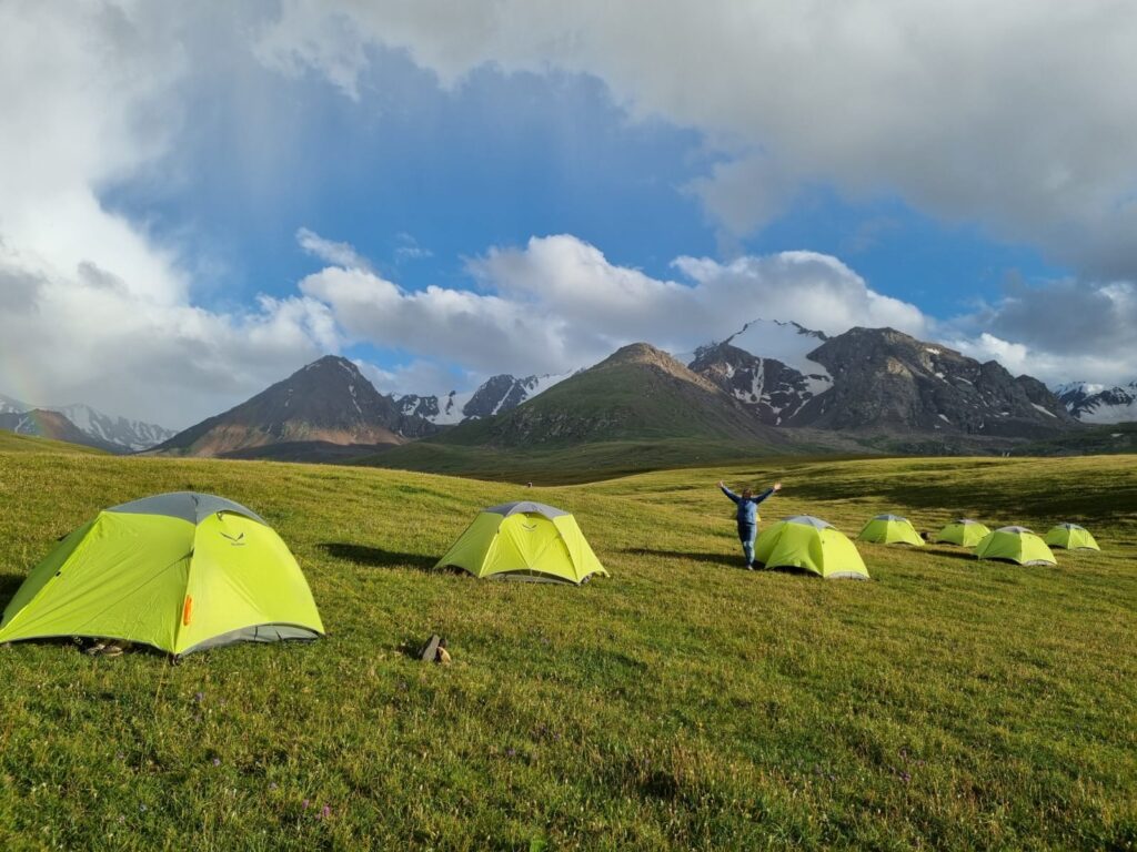
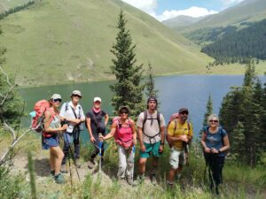
The tour begins in Kyrgyzstan, where dramatic trekking routes through the Tian Shan Mountains lead across alpine passes, turquoise mountain lakes, and remote valleys accessible only on foot. Travelers camp in pristine wilderness, supported by a local horse team, before descending to the shores of Issyk-Kul Lake. Here, the rhythm of the journey shifts toward cultural immersion during the World Nomad Games, a rare international gathering celebrating traditional sports, craftsmanship, and nomadic heritage.
From the ancient Silk Road city of Osh, the route continues into Tajikistan, ascending into the High Pamirs along the legendary Pamir Highway. The journey crosses some of the world’s highest drivable passes, vast plateau landscapes, and isolated settlements shaped by altitude and climate. Entering the Wakhan Valley, travelers explore a historic frontier once shared by empires, framed by the towering peaks of the Hindu Kush in Afghanistan.
The active highlight of the Pamirs is a trek to the high meadows beneath Engels Peak, followed by a journey into the Bartang Valley and a hike to the remote village of Jizev, accessible only on foot and surrounded by alpine lakes and birch forests. The route then follows the Panj River, the natural border with Afghanistan, before descending to Dushanbe, the capital of Tajikistan.
This itinerary balances serious trekking, high-altitude travel, and deep cultural encounters, offering a rare opportunity to experience Central Asia’s landscapes and traditions beyond standard routes.
Itinerary
Arrival in Bishkek, the capital of Kyrgyzstan.
In the morning, we visit Osh Bazaar, one of the most vibrant markets in the country, where local farmers bring fresh produce early in the day. Bazaars are an essential part of daily life and provide a strong introduction to local culture.
We continue with a city tour, visiting Ala-Too Square, the Philharmonic Hall, the Manas Monument, the State Historical Museum, and a local mosque.
Lunch at a local restaurant.
In the afternoon, excursion to Ala-Archa National Park, an alpine gorge known for its dramatic peaks, glacial rivers, and fresh mountain air. Short walks in the valley.
Dinner is independent; the guide will recommend restaurants.
Overnight: hotel in Bishkek
Meals: lunch
Final altitude: Bishkek – approx. 800 m
Driving: ~180 km | ~3–4 hours | Hiking: ~4–5 hours | ~10 km
After breakfast, we drive east to Chon-Kemin National Park, where we meet the local trekking team and horses for luggage transport. From the trailhead (approx. 1,750 m), we begin trekking toward Tory-Aigyr Gorge.
The trail ascends through forested slopes and open alpine meadows, often filled with wildflowers and edelweiss. The landscape gradually opens into high mountain pastures.
Arrival at the campsite in the upper gorge.
Overnight: tent camp
Meals: breakfast, lunch, dinner
Final altitude: Tent camp – approx. 2,520 m
Elevation gain: +770 m
Hiking: ~4–5 hours | ~10 km
After breakfast, we begin a scenic trekking day across two mountain passes.
The first ascent leads to Tory-Aigyr Pass (2,790 m), followed by a descent to a river crossing. We then climb again toward a second pass (approx. 2,780 m).
Lunch is taken at the pass with panoramic views of the surrounding peaks. In the afternoon, we descend toward the stunning Kol-Tor (Kol-Kogur) Lake, a sapphire-blue alpine lake set among snow-covered mountains.
Camp is set near the lake.
Overnight: tent camp
Meals: breakfast, lunch, dinner
Final altitude: Lake camp – approx. 2,480 m
Highest point: 2,790 m
Hiking: ~5–6 hours | ~13 km
Today’s trek climbs steadily to Kol-Tor Pass (3,350 m), the highest point of the Kyrgyz trekking section. The trail crosses wide alpine meadows where shepherd families live during summer months with their livestock.
After reaching the pass, we enjoy expansive views before descending approximately 790 m into the lower valley. Camp is set near a mountain stream with drinkable water.
Overnight: tent camp
Meals: breakfast, lunch, dinner
Final altitude: Tent camp – approx. 2,560 m
Highest point: 3,350 m
Hiking: ~3–4 hours | Driving: ~3–4 hours
After breakfast, we complete the final trekking section, descending along the valley toward the trail exit near Kol-Tor Valley. Lunch is taken as a picnic.
We meet our vehicle and transfer to Cholpon-Ata, located on the northern shore of Lake Issyk-Kul (1,600 m). The remainder of the afternoon is free to swim, relax, or enjoy the lakeside.
If time permits, we may attend World Nomad Games events.
Overnight: hotel in Cholpon-Ata
Meals: breakfast, lunch
Final altitude: Cholpon-Ata – approx. 1,600 m
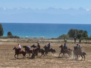
A full day dedicated to the World Nomad Games, depending on the official schedule. Events may include:
- traditional horse games (Kok-Boru, Er Enish, Kyz Kuumai)
- eagle hunting demonstrations
- wrestling and archery competitions
- crafts fair and cultural performances
Time to explore the festival grounds and experience the vibrant international atmosphere.
Overnight: hotel in Cholpon-Ata
Meals: breakfast, lunch
Final altitude: Cholpon-Ata – approx. 1,600 m
Distance: ~160 km | Driving time: ~3–4 hours
Drive along the northern shore of Issyk-Kul. Visit the Ethnic Village of the World Nomad Games in Semenov Gorge, where yurts represent nomadic cultures from across Central Asia. Picnic lunch.
Continue to Karakol. City tour including the Dungan Mosque, Holy Trinity Orthodox Church, and a women-led community craft initiative.
Dinner with a Dungan or Uighur family, offering insight into the region’s multicultural heritage.
Overnight: hotel in Karakol
Meals: breakfast, lunch, dinner
Final altitude: Karakol – approx. 1,700 m
Driving: ~3–4 hours. | Hiking: ~4–5 hours | ~12 km
Morning transfer to Jety-Oguz Gorge, famous for its red sandstone formations. We begin a scenic trek through forested paths toward Svetlaya Polyana, with views opening toward alpine meadows and distant peaks.
From Jety-Oguz Pass, weather permitting, enjoy panoramic views before descending back into the gorge and visiting Jety-Oguz Waterfall. Picnic lunch.
In the afternoon, visit Skazka (Fairy Tale) Canyon for a short hike among colorful clay formations. Optional swim in Issyk-Kul or visit hot springs in Kadji-Sai. Continue to Bokonbaevo.
Overnight: family guesthouse in Bokonbaevo
Meals: breakfast, lunch, dinner
Final altitude: Bokonbaevo – approx. 1,600 m
Driving: ~280 km | Driving time: ~4–5 hours
Flight: Bishkek → Osh
After breakfast, we drive toward Bishkek with a stop at the Burana Tower, an 11th-century minaret and Silk Road monument. Lunch with a local family in Don-Aryk village.
Transfer to the airport for a domestic flight to Osh, the southern capital of Kyrgyzstan and an important Silk Road city. Short city walk including Suleiman-Too.
Overnight: hotel in Osh
Meals: breakfast, lunch
Final altitude: Osh – approx. 900 m
Driving: ~4 hours | Distance: ~350 km
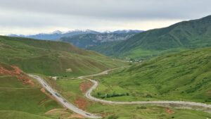
After breakfast, we depart from Osh and drive south through the wide landscapes of the Alai Valley. The road gradually climbs into high-altitude terrain, crossing Taldyk Pass (3,615 m), with panoramic views of alpine pastures and distant snow-covered peaks.
We continue via Sary-Mogol village to Tulpar-Kul Lake, located at approximately 3,500 m at the foot of Lenin Peak (7,134 m). The afternoon is spent walking around the lake and acclimatizing in one of the most iconic high-mountain landscapes of Central Asia.
Dinner and overnight in a traditional yurt camp near the Lenin Peak Base Camp area.
Overnight: yurt camp
Meals: lunch, dinner
Final altitude: Tulpar-Kul – approx. 3,500 m
Driving: ~6 hours | Distance: ~310 km
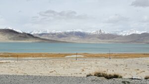
After breakfast, we return to the Pamir Highway and ascend toward Kyzyl-Art Pass (4,280 m), crossing the Kyrgyz–Tajik border. After border formalities, the landscape opens into the vast, stark plateaus of the Eastern Pamirs. We stop at Karakul Lake (approx. 3,900 m) for lunch and a short walk along the shore of this immense crater lake, formed by a meteorite impact. Weather permitting, views toward distant snow-covered peaks add to the dramatic scenery.
In the afternoon, we continue over Aq-Baital Pass (4,655 m) — the highest point of the Pamir Highway — before descending to Murghab, the highest town in Tajikistan.
Overnight: homestay in Murghab
Meals: breakfast, lunch, dinner
Final altitude: Murghab – approx. 3,666 m
Driving: ~3.5–4 hours | Distance: ~180 km
Today we travel across the wide desert valleys of the Eastern Pamirs, passing remote settlements and grazing areas for yaks and sheep. The route leads toward the Alichur Plateau, traditionally used as summer pasture by nomadic herders.
Arrival in Bulunkul, known as the coldest permanently inhabited place in Tajikistan. In the afternoon, we explore Bulunkul Lake (3,735 m) and nearby Yashilkul Lake (3,719 m), famous for their changing colors and birdlife.
Overnight: homestay in Bulunkul
Meals: breakfast, lunch, dinner
Final altitude: Bulunkul – approx. 3,735 m
Driving: ~4–5 hours | ~160 km
After breakfast, we drive along the shoreline of Yashilkul Lake, stopping for photos and short walks. From here, the road climbs over Kargush Pass (4,344 m) before descending into the legendary Wakhan Valley.
As we approach the Panj River, the natural border with Afghanistan, the landscape changes: terraced fields and villages appear along both sides of the river, with views of the Hindu Kush Mountains across the border. Arrival in Zong, the first village of Wakhan.
Overnight: homestay in Langar
Meals: breakfast, lunch, dinner
Final altitude: Zong – approx. 3,200 m
Driving: ~1 hour | Hiking: ~6–7 hours
In the morning, we drive to Zong village, the starting point of today’s trek. The trail follows a narrow water channel and gradually ascends through alpine terrain to a high mountain meadow at approximately 4,000 m.
From the meadow, we enjoy wide panoramic views of Engels Peak (6,507 m) and surrounding summits, with dramatic vistas across the Wakhan Valley and toward Afghanistan. Picnic lunch in the highlands.
After lunch, we descend back to the valley and return to the village Langar by another trail
Overnight: homestay Langar
Meals: breakfast, lunch, dinner
Altitude gain and loss: + 1000 m, – 1000 m
Highest point: ~4,000 m
Final altitude: approx. 2,800–3,000 m
Driving: ~6–7 hours | ~230 km
Today we explore the cultural and historical highlights of the Wakhan Valley. Visits include:
- ancient shrines and sacred trees
- a Buddhist stupa (4th century AD)
- the house museum and solar calendar of Sufi Mubarak
- a traditional Pamiri house
We also visit the Bibi Fatima hot springs (optional bathing) and Yamchun Fortress (3rd–1st century BC), offering sweeping views across the Wakhan Valley and the Hindu Kush.
After lunch in Ishkashim, we continue to Khorog, the capital of Gorno-Badakhshan.
Overnight: hotel or guesthouse in Khorog
Meals: breakfast, lunch, dinner
Final altitude: Khorog – approx. 2,200 m
Driving: 100 km ~3 hours | Hiking: ~2–3 hours
Leaving the Pamir Highway, we enter the remote Bartang Valley, one of the most isolated regions of Tajikistan. At the trailhead, we cross a footbridge and begin trekking toward Jizev village, accessible only on foot.
The trail follows a narrow valley with cascading alpine lakes, birch forests, and clear streams. Jizev is a self-sufficient mountain village, isolated for several months each winter.
Overnight: homestay in Jizev
Meals: breakfast, lunch, dinner
Final altitude: Jizev – approx. 2,600 m
Hiking: ~2 hours | Driving: 300 km, ~5–6 hours
After breakfast, we trek back to the road and meet our driver. We then follow the Panj River downstream, traveling through deep gorges and fertile river valleys. For much of the day, Afghan villages are visible across the river, offering a rare glimpse into daily life along this historic frontier.
Arrival in Kalaikhumb, the administrative center of the Darvaz region.
Overnight: guesthouse in Kalaikhumb
Meals: breakfast, lunch, dinner
Final altitude: Kalaikhumb – approx. 1,200 m
Driving: ~7 hours | Distance: ~350 km
The final day of the journey leads us gradually out of the high mountains. The road winds through scenic valleys and tunnels, with a lunch stop in Kulob. In the afternoon, we arrive in Dushanbe, the capital of Tajikistan, marking the end of our journey across Central Asia.
Overnight in hotel. Dinner – self catering
Meals: breakfast, lunch
Final altitude: Dushanbe – approx. 800 m
Included
- Accommodation in hotels, guesthouses, homestays, and yurt camp
- All ground transportation (4WD vehicles in Tajikistan, Minibuses in Kyrgyzstan)
- Professional English-speaking guide
- Local hosts and cultural facilitators
- Meals as indicated in each day of the program (breakfast, lunch and dinner)
- Drinking water (1.5 liter per person per day)
- Entrance fees and cultural activities as per itinerary
Not included
- International flights
- Domestic flight Bishkek → Osh around 70 – 80 USD per person (subject on change)
- Dinners in cities (Bishkek, Osh, Khorog, Dushanbe)
- Tickets to specific Nomad Games competitions (if applicable)
- Visa support and GBAO permit (if required)
- Personal expenses and tips
- Single room supplement
- Early check in of hotels
- Money transfer fee
- Full Board Meal
Dates and prices
About us
NovaTravel is a community of women travelers creating safe and inspiring tours across Central Asia.
Destinations
Information
Contacts
© 2026 NovaTravel. All rights reserved